The hydrology of the Peak District limestone 'dome' is extremely complex and still only partially understood, with much research and investigation still to be done. On the western, northern and eastern fringes of the dome, much younger strata overlay the limestone in a rim of high eroded edges/ridges, and in many areas their surface water drains directly onto it. In most cases it sinks into natural cave passages; these input points are commonly known as 'swallows' or 'swallets', and are formed from a combination of chemical solution (from mildly-acidic rainwater) and abrasion (from quartz grit borne in the streams). Where the sinking water meets impervious rock again, usually shale in the flat valley-floors, the water is forced to resurge to the surface and thus flows into rivers, but it is believed some of the water is 'lost' in deep phreatic conduits taking the water further east, essentially remaining within or on top of the limestone until it contacts more porous rocks.
In other areas of the limestone, beds of impermeable rock (usually lavas or clay wayboards resulting from volcanic emissions) prevent water from sinking, and it is forced to flow along the surface as rivers and streams; these are sometimes intermittent depending on rainfall. These impermeable beds can also be found underground, sometimes creating artificially high water-tables where they occur. In the southern areas the topographic change is more gradual onto soft red sandstone, and much of the water draining from the limestone sinks beneath the younger cover.
Many areas of the Peak District have dry valleys or dales, resulting from ancient hydrological activity when water levels were much higher, and ancient caves can often be found along the rims of the valleys, often still part-filled with sand/clay sediments from glacial inwash of eroded overlaying strata before the valleys were cut down. In some cases hydrological activity and cave formation is still taking place below the valley floors, within the present water-table.
The other major factor affecting water levels are the numerous 'soughs' or drainage-levels, created by lead miners during the 16th-19th centuries. These were specifically designed to lower the water-table within lead-bearing high ground, by draining the water into the lowest convenient natural conveyance (usually a nearby river or stream), via a long, gently-inclined passage excavated at the base of the mine, although dry valleys were sometimes used as a conduit if the topography (and landowner) allowed. Enterprising mine and mill-owners even used them to drive waterwheels where practical, before final discharge.
Many of these soughs were miles long, and often had branches into other districts, and so were capable of draining vast areas of ground in a very short time (compared with geological timeframes). As most of the soughs are still active, they have permanently altered much of the natural hydrology, and in many cases will have completely halted any ongoing cave development that may have been taking place within the active hydrological zone at the time they were created. Some have been established for so long, and their flows are so strong and reliable that they are used as water-sources for human use.
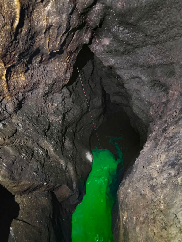
This section details the dye-tracing work that has taken place so far, and the data can be viewed by project or by trace.